By: María Isabel Carmenate Bringa & Nélida López Avila
Current trends to resolve the old urban transport-pedestrian conflict point to developmentalist models that tend to give priority to the automobile, adaptable to modern cities with a road structure designed for this purpose or those that opt for the pedestrian as the protagonist of public space for historic areas of high heritage value.
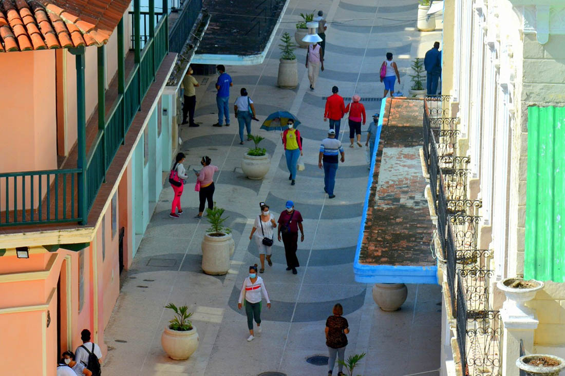
The historic center of Camagüey is not exempt from this problem, which is why it becomes more and more an urgent need to achieve a feasible order for mobility that defines the protagonist of the public space. Its fundamental premise is that locals and visitors have priority through the pedestrian link of the five main spaces from the link of the foundational area of the Agramonte park with Workers’ Square, the José Martí park, the San Juan de Dios and Carmen squares, allowing safe and direct travel routes with attractive connections where the values of the legendary Camagüey are appreciated. In this area there is a low percentage of pedestrianization represented by the Soledad, Mayor alleys; the San Juan de Dios and Carmen squares.
The coexistence pedestrian axis generally prohibits the access of vehicles and only admits the exceptional passage of emergency vehicles, as well as those intended for the supply of goods during certain hours and resident individuals. In this modality, the restrictions vary depending on the location and use, for example, on Maceo and República streets, emergency cars are allowed to pass due to fire or other contingencies, but not service cars or resident parking.
Pure pedestrian streets acquire a function that justifies the permanence of the closure, such is the case of Callejón de la Soledad and the section of Martí street between Cisneros and Independencia; In both examples, the gastronomy service offered in their establishments was extended.
Genesis…
At the beginning, it was necessary to carry out a comprehensive analysis of urban roads and their flows. A system was created that articulates the categorization of roads with traffic, transportation, parking and the aforementioned process. Rules emerged from the study that discourage and purge the entry of transport, as well as the construction of roads to obtain connections at the city level.
The Plan, through its stages, has gradually implemented a group of actions such as the section of Martí Street between Cisneros and Independencia, the square, Maceo Street, a section of República Street and Van Horne, which, although not contained in the ZPCH, influences its urban mobility.
The pedestrianization proposed for Independencia street, planned for the first stage of the Plan, is resumed from Hermanos Agüero street to Ignacio Agramonte, it has a high urban centrality with a high volume of traffic that generates road indiscipline, also concentrating a large number of buildings of protection degree 1 and 2.
The second stage projects the connection of Agramonte Park with José Martí Park, Plaza del Carmen and San Juan de Dios, links of great complexity due to the collateral organizational measures that derive.
The link with the Martí park includes the street of the same name with a vehicular closure of a section in 2011 (opposite Agramonte park) from the corner of Cisneros (opposite one side of Agramonte park) to the conclusion of Martí park, in order to link both public spaces.
Hermanos Agüero Street forms the junction with Carmen square, using part of the Independencia pedestrian path, which will establish an extensive route between Agramonte Park and the cultural-residential center, Carmen. Of vital importance for comprehensive resuscitation will be the insertion of services related to culture, gastronomy, commerce, recreation and others.
The nexus with the San Juan de Dios square is more complex, since the axes that favor it (Cisneros, Pobres, San Clemente and González Hurtado alley) are committed to the city’s roads, so the definitive solution will be established in later stages.
Pedestrianization processes are not alien to participatory principles in urban planning, regardless of the scale or subject matter. In Camagüey, institutional and citizen participation has had an indispensable impact to achieve such purposes.
The community and its decisive role
The organization of popular consultations, inter-institutional work meetings over a period of more than five years, and constant on-site assessments in order to visualize and technically control road congestion, as well as traffic levels at certain times of the day, have been precise actions and, in turn, necessary moments of informative feedback.
The already established pedestrian areas still encounter resistance from road users with motorized and human-powered transport (bicycles, pedicabs, etc.), fundamentally due to the loss of the direct link between one connecting axis and another, since it implies greater travel and the consequent waste of time and fuel. In the context of urban mobility, alternative transport becomes a necessity, its dialogue with the environment and heritage helps to enhance the value of heritage assets.
It is not enough for specialists to know the heritage, environmental, social and economic benefits generated by the transformations, if the driver of any type of vehicle does not know or internalize the benefits that the program brings to the historic area, especially when it has distinguished worldwide recognition by the urban fabric that organizes the structure and functioning of the area.
Through projects of revival, rehabilitation, remodeling, or comprehensive revitalization of each pedestrian zone, the tangible and intangible heritage values are preserved, in addition to incorporating new functional and design values into the urban landscape that stimulate the passer-by when he walks through suitable scenarios.
Translated by: Aileen Álvarez García